Highlighting weather risk for global security operations centers with TopoONE
5.11.2021//Client Stories, API & Mapping
Known for their powerful TopoONE platform, Greater Atlanta-based Topo.ai is an industry pioneer in technology-enabled corporate security, delivering real-time geospatial processing of critical risk intelligence combined with interactive mapping solutions. As the first to develop these geospatial risk technologies with a wide variety of data feed integrations - such as local & national news, IoT data, public health, flood, fires, and basic environmental conditions - Topo.ai has attracted an ever-expanding and diverse portfolio of customers that spans multiple industries.
TopoONE’s portfolio of use-cases is diverse, supporting business continuity, supply chain stability, traveler risk management, physical security and event security. That flexibility equates to a platform broad enough to satisfy nearly any industry’s requirements. With a robust feature set focused on key command center functions: visualization, workflow, and analytics, their cloud-based solution is purpose-built to support key security functions.
The challenge
Corporate security is a complicated yet necessary element for businesses in today’s connected world. The multifaceted threats that these teams face require disparate solutions and data sources, often proving to be cost prohibitive for an organization to unify on their own. Topo.ai sought to create a common operating picture capable of displaying multiple threats in unison, ensuring maximum awareness, and reducing the herculean task of monitoring countless screens via a single user interface. While successful in this endeavor, there was a missing piece – hyper-local and actionable weather.
As 90 percent of the S&P Global 100 Index identified extreme weather and climate change as a current or future risk, with one-third claiming they’ve already faced adverse effects, weather was an obvious requirement to fully support their clients. In their search for a weather partner, they sought a data provider capable of providing high-resolution weather data and imagery in an efficient and reliable manner – and found that partner in Xweather.
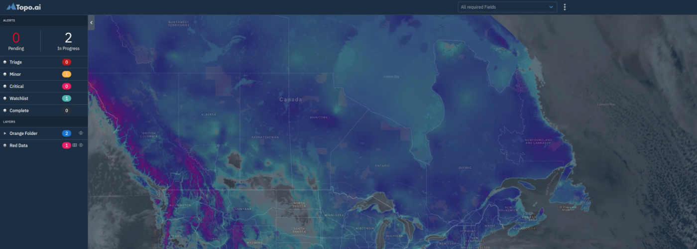
The solution
In order to create a common operating picture which offers full geographic coverage to support global security operations centers (GSOCs) and covered the breadth of potential threats, Topo.ai and Xweather worked together to overcome this mountain.
Taking advantage of a combination of Xweather Flex and our webhook delivery format,, the TopoONE team integrated mapping layers, data sets, and began delivering Severe Weather Alerts (US, Canada, Europe), Wildfires (US, Canada), Earthquake (Global), and Tropical Cyclones (Global). These GeoJSON datasets enabled TopoONE to instantaneously inform their customers – those with both static and mobile assets - of environmental changes as they occur and, as assets move. TopoONE now provides a complete picture of environmental threats in real-time.
The results
In successfully integrating Xweather's data and imagery, the TopoONE platform now incorporates one of the broadest selections of environmental data and makes it available to their clients. This empowers corporate security teams to track assets (mobile or static), events, and people in order to keep them aware of security threats and coordinate a rapid response when necessary. TopoONE is arming some of the world’s leading corporations with automated reporting, analytics, and a unified visualization of security threats, protecting their staff and bottom line.
How can weather benefit your operations?
Take our data and mapping for a free 30-day test drive or talk with one of our technical experts to learn more.